The Flood Tool
Google Earth is a remarkable resource. It’s free, for starters! Google Earth is embedded with altitude data. As such, a programmer called Bernard Sterzback in Germany has come up with a clever .kmz extension file that can be installed, and used to access that embedded altitude data to show ‘flood’ maps, in order to show what land projects above a user-input elevation level.
This is useful for determining the ‘within 25m of the summit’ Activation Zone for SOTA, as well as for hillwakers in determining likely paths and ridges, and the widths of such ridges.
To use the tool, first you will need to download this .kmz file link – KMZ Flood Tool for Google Earth
When it has downloaded, run it, and it will associate itself with Google Earth automatically.
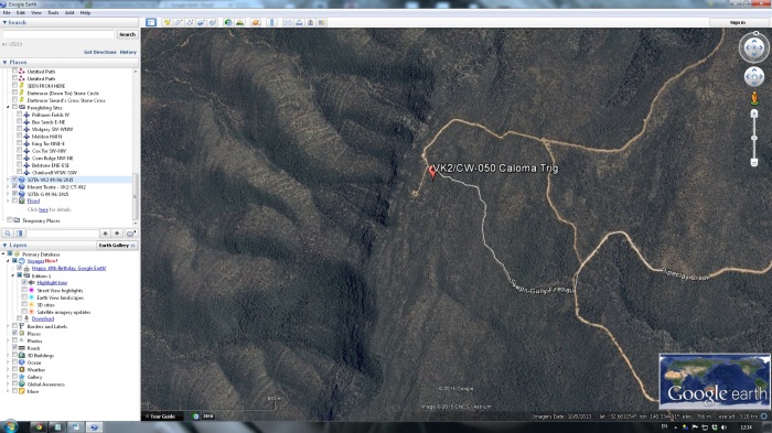
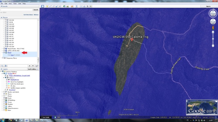
Next, open Google Earth and head to a point of interest. I’ll use a SOTA summit – VK2/CW-050 – Caloma Trig Point for this example.
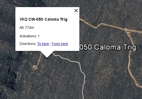
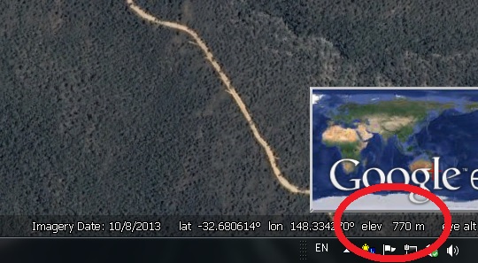
Next thing we need to do is determine the elevation of this summit. We can either click on the Google Earth placemarker, or move the mouse cursor to that point and read the elevation off the info bar at the bottom of the screen. Make a note of the summit altitude.
In this case, the reported elevations are pretty close, but I’ll go with the ‘official’ SOTA elevation of 774m.
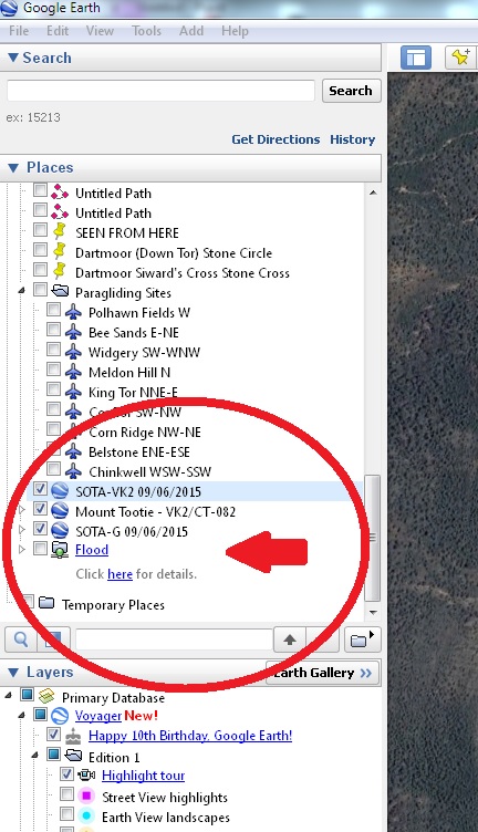
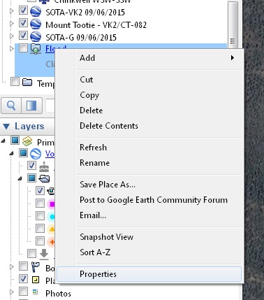
Next, looking in the ‘Places’ collapsible dropdown on the left hand side of the Google Earth window, you should see your new ‘Flood’ tool you installed. Hover over it with the mouse, click the right mouse button, then left click ‘Properties’
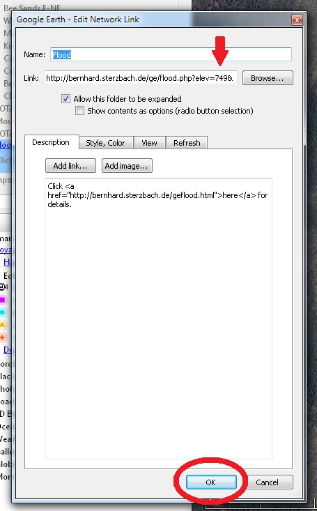
In the window that opens, you can now edit the ‘Link’ data, which is the flood level you want to set to view. In my case, I want to see what area of land is available within 25m of the summit, so I edit the number to become 749 (ie. 25m less than 774). You must leave the ampersand ‘&’ symbol in at the end.
Then, click the [OK] button.
Now, you can enable the Flood Tool by clicking its check box, and the area will be ‘flooded’ to the level you just set, showing only the land remaining from 25m below the summit, to the summit. This is the SOTA Activation Zone. Easy, wasn’t it?! Once you’ve done it a few times, it becomes quite intuitive.
To clear the Flooded area, simply un-check the Flood tool.
See you on the summits, within the calculated Activation Zones!

This looks pretty cool. I’m going to give it a go.
Thanks for posting
LikeLiked by 1 person
Thanks Rick. Yes, it’s a very handy tool for a whole number of purposes – not least of which determining activation zone areas! An experienced mountaineer friend I showed it to said he could use it to determine skyline traverses from Google maps, for instance.
LikeLike
I tried it yesterday and it worked quite well. I just shared it with my AZ SOTA group (Arizona). One question, being yanks, we’re used to Imperial units, is there a way to work this in feet as opposed to meters?
LikeLiked by 1 person
Hi Rick, I don’t think so, no. The guy who wrote the kmz tool is in Europe, so of course uses metres too. You’ll need to leave a calculator open on the screen and remember 1m = 3.2808ft !
73 – Rob VK2GOM
LikeLike
Great work Rob!
LikeLiked by 1 person
Rob, it’s not a problem. I download the SB into GE off the SOTA mapping project. You right click on the summit marker and it gives you the summit details, including elevation in feet & meters. Our AZ is 80 feet which is essentially 25 meters. I think we can not worry too much about the 2foot difference, hi hi.
Again thanks for pointing me to think. It will be very useful.
73 Rick
K7TEJ
LikeLike
Hi Rob,
Thanks for the info, it is a handy thing to know and makes it easier to decide where to set up portably before you even leave the house! I had a bit of a struggle to get Google Earth to run on my Linux platform, but once I got it worked out, your instructions were easy to follow. 🙂
73,
Amanda
VK3FQSO
LikeLiked by 1 person
Within GE, I traced around the 25m elevation boundary with the path tool, saved the kmz file and converted it to gpx format using http://www.gpsvisualizer.com/ With the gpx file loaded in to the gps, it then displays the boundary as a track. You can now see the elevation limits on the gps!
73
David
VK2JDR
LikeLike
Nice tip David. I have used similar path methods to mark out mineral claims for when I’ve been out in the bush Gold prospecting!
LikeLike
I like the idea
LikeLike
Just found this blog post. Great tool for planning SOTA activation’s, especially in areas where the actual summit may be on private property.
LikeLike